top of page

Actionable Aerial Intelligence for Oregon’s Land Managers
We turn complex drone data and multispectral imaging into
clear, profitable decisions for timber, agriculture, and vineyards
Our Services


Vineyard
Sub-inch canopy vigor mapping, missing vine counts, and targeted disease stress detection.

Nursery
Automated container counting, bare-root inventory, and block-level health grading. Catch irrigation leaks and disease before plants ship.
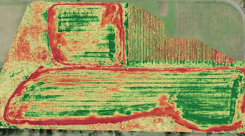
Open Field
Early-season stand counts, variable-rate prescription (Rx) maps, and yield estimation prep.
bottom of page